Middle Third Geological (MTG) is a niche Brisbane (Queensland, Australia) based consultancy
providing high quality Engineering Geological services to the dams, hydropower, and mining industries,
primarily within Australia.
We have significant experience offshore, with our team completing projects in Oman, China, Myanmar, New Caledonia, Papua New Guinea, and New Zealand. Our familiarity with Standards and Guidelines other than those in Australia allows us to seamlessly integrate with existing project teams to bring high quality outcomes to meet project timelines.
We have a well developed understanding of the concerns and requirements of Owners and Regulators and develop procedures and specifications to ensure a high quality result is achieved whilst maintaining dam safety.
Our Services

Data Mining + Analysis
Geological investigations for new and existing dams, including:
-
Data Mining: Identification of data sources, data acquisition, digitisation, spatial registration, indexing. Data quality assessment. Modernisation from previous units of measure or Standards for correlation and compliance.
-
Desktop Assessment: Review of historical data, gap analysis, preliminary interpretation, preliminary analysis, investigation scope development to close gaps.
-
Reporting: Reporting, figure, map, plan, and drawing development, publication.
-
Investigation: Specification development (for compliance with Standards (AS1726-2017, NZ Guideline), Regulations and ANCOLD Guidelines), [assistance with] contract development, logistics, execution, sub-contractor management, survey, geophysics, environmental & geomechanical testing.
Software: Claris FileMaker Pro, Microsoft Excel, Microsoft Word, Golden Software Grapher, ARES Commander, QGIS, Rocscience DIPS, Rocscience RSData, PDF-XChange Editor Pro.
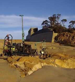
Investigation
- Mapping: Geological mapping (regional, local, & foundation scale), high quality data collection using QField, conventional geological compass measurements.
-
Intrusive Investigation: Extensive supervision of drilling through live dams, logging of soils and rocks, high quality defect description. Audit logging. Concrete coring. Water pressure testing. In situ stress testing. Installation of instruments (inclinometers, vibrating wire piezometers, etc). Installation of groundwater monitoring and production bores. Post investigation void reinstatement supervision.
-
Laboratory Testing: Sample preservation, Chain of Custody, laboratory liaison, testing methodology and specification, data management, database development, laboratory QA + QC checks.
Software: Claris FileMaker Pro, Microsoft Excel, Microsoft Word, Golden Software Grapher, QGIS, Rocscience DIPS, Rocscience RSData.
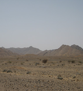
Geological Environment
Dimensions: Development of two-dimensional and three-dimensional geological models using conventional [hand-drawn] methods or digital methods. IAEG Commission 25 Guidelines (2022)
Model Types:
-
Conceptual: Based on reconnaissance visit/s, literature review, experience, and historical data. Limited observation - Mainly interpretation.
-
Preliminary/Design Model: Based on site data from non-intrusive and intrusive investigations, geological mapping, geomechanical testing. Domain development. Increased observation - Less interpretation.
-
Construction Model: High resolution mapping of exposures, additional intrusive works, model of record. Near complete observational record - Limited interpretation. Document of record.
Software: QGIS, ARES Commander (CADD), Golden Software Surfer.
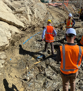
Foundation Assessment
Foundation Characterisation:
-
Domains: Geological, geotechnical, and geomechanical domain interpretation, definition, and assessment.
-
Kinematic Assessment: Defect driven failure processes. Defect strength assessment. Rock mass strength assessment.
-
Susceptible materials: Piping, liquefaction, internal erosion, suffusion, halloysites.
-
Excavation domains: Top soil, soil, weathered rock, conventional excavation, rock breaking and blasting, expected foundation level. Foundation consolidation.
Software: QGIS, ARES Commander, Golden Software Surfer.
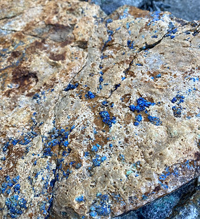
Resources + Construction
Construction Material Assessment: Investigation of/for potential sources, Commercial and Private resources options, material investigation, quantification, liaison with permitting agencies, geomechanical characterisation.
Site Services:
-
Construction material compliance.
-
Geological hazard identification (kinematic, bearing, etc)
-
Foundation and excavation mapping.
-
Foundation preparation and treatment processes and compliance.
-
Foundation approval.
-
Grouting, drainage, and anchor drilling supervision.
-
Data management.
-
Digitisation of mapping data to GIS.
Inspections
Dam Safety Review:
-
Five (5) and twenty (20) year Dam Safety Review inspections.
-
Failure Impact Risk Assessments.
-
Comprehensive Risk Assessments (CRAs).
-
Portfolio Risk Assessments (PRAs)
-
Risk validation through investigation.
-
Analysis and interpretation of monitoring data.
-
Literature review.
-
Core review.
Technical Review + Legal
Technical Review Panel:
-
Geological review for:
-
Owners.
-
Investors.
-
Regulators.
-
Insurers.
-
Legal:
-
Preparation of Briefs of Evidence.
-
Provision of Opinion.
Specialties
Specialty assessment services include:
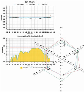
Six-Ways Method Geological Strength Index: Robust estimation of Geological Strength Index (GSI) using Six-ways method drawing on multiple input sources to reduce uncertainty in GSI estimation and removing 'visual classification' issues. (Burns & Forster, 2023)
Joint Roughness Coefficient Analysis: Digital processing method to consistently import joint surface profiles for estimation of Joint Roughness Coefficient (JRC), asperity (i), and the initial dilation angle (id). (Forster & Forster, in prep)
Rock Condition Number: Assessment of foundation conditions using borehole data to assign a Rock Condition Number (RCN), allowing foundations to be modelled to highlight areas of poor quality material. (Forster, 2016)

